


When Brazil inaugurated Brasília in 1960, the country moved its capital deep into the interior and unveiled a new city of modernist government buildings. For the first time, a nation designed its political center not around an existing settlement but around an idea. That ambition raised a question that still shapes planned capitals today: can a city conceived almost entirely at once ever develop as naturally as one that evolves?
Some nations answered with greater success than others. Malaysia’s Putrajaya steadily grew into a functioning administrative center while Naypyidaw still struggles with empty districts and oversized infrastructure. That contrast is what makes planned capitals so compelling. They reveal how architecture can project power and ambition, yet still depend on everyday urban life to give a city meaning.
Brasília

Country: Brazil
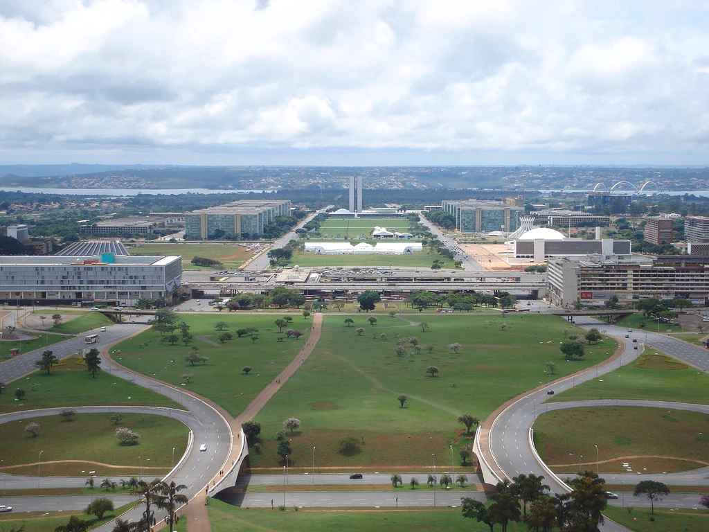
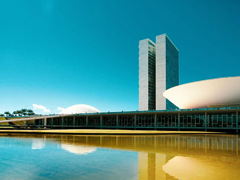
Brazil relocated its capital from Rio de Janeiro to the country’s isolated interior by building Brasília, designed by Lúcio Costa with Oscar Niemeyer, who shaped its monumental architecture. The city fused utopian ideals with Le Corbusier’s Ville Radieuse through the Pilot Plan, which is a two-axis plan that resembles modern aircraft. Along the Monumental Axis, the sculptural government buildings emerge from massive open plazas. At its cockpit, the Plaza of the Three Powers houses the National Congress, which has twin towers and opposing parabolic domes.

Beside this is the Palácio do Planalto and the Supreme Court, whose colonnades, curved pilasters, and reflecting pools exemplify Brazilian modernism. Further along, the Metropolitan Cathedral’s 16 bent concrete pilasters expand upward like a crown with colored glass mosaic flooding the inside, while the National Theatre takes on a stark pyramidal form. Despite its idealism, Brasília prioritized automobiles while displacing workers to peripheral settlements that evolved into sprawling informal towns.
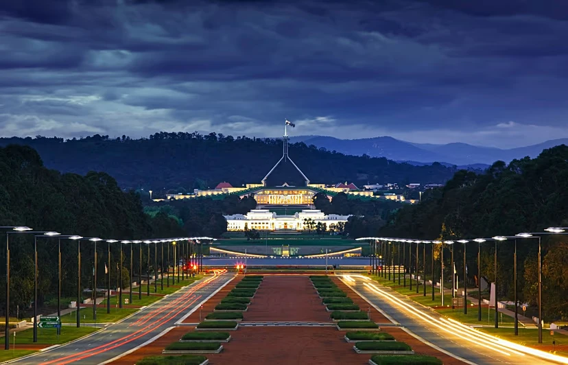
Canberra

Country: Australia
Walter Burley Griffin’s 1911 competition-winning concept centered on a geometric triangle drawn over the Molonglo River valley and aligned with Mount Ainslie, Black Mountain, and Pleasant Hill. Griffin treated the landscape as the primary architectural material with tree-lined avenues defining the triangle’s edge. They placed government buildings along ascending terraces overlooking the lake while locating commercial and residential districts on the opposite edge of the basin.

Capitol Hill stood at the apex of the triangle, where the convergence of avenues resolved into a rotary sweeping around the crest intended to serve as the symbolic center. Griffin and Marion Mahony Griffin also envisioned a massive tiered pyramid housing area with a vaulted interior for assembly and national archives. Although officials removed Griffin from the project in 1920, planners retained most of his suggested city’s axial layout and modified the lake system. The current Parliament House preserves only a faint echo of Griffin’s original vision, its minimalist steel structure tracing a bare pyramidal form.
Sejong City

Country: South Korea
South Korea built Sejong, located 121 kilometers south of Seoul, to shift administrative activities away from the increasingly congested capital. Unlike many purpose-built capitals, Sejong prioritizes infrastructure, environmental integration, and technology management. Throughout the city, it features solar-powered buildings, automated waste collection, and electric car infrastructure. The Government Complex rooftop garden stretches across 15 interconnected buildings over 3.6 kilometers, making it the world’s largest rooftop garden.

The Geumgang Pedestrian Bridge, also called the Ieung Bridge due to its resemblance to the round Korean letter, separates cyclists and pedestrians across levels, minimizing dependency on automobiles. Sejong National Library and Sejong Art Centre exemplify sculptural municipal architecture. Developers also converted former industrial structures in nearby Jochiwon into contemporary art spaces, retaining exposed brick and steel from the old paper mill.
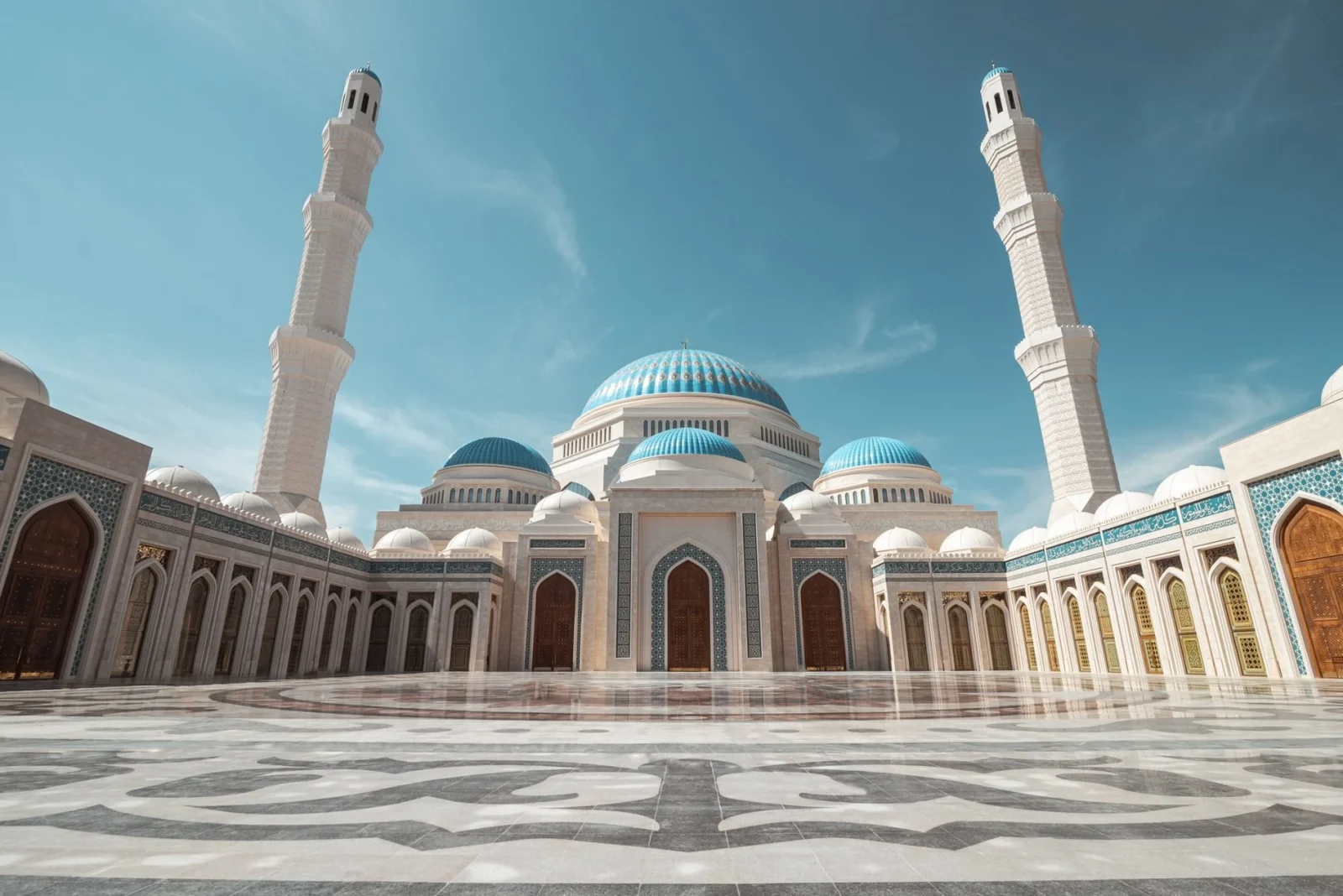
Nur-Sultan / Astana

Country: Kazakhstan
Aqmola rose from the flat steppes of northern Kazakhstan into the spectacle-driven capital of Astana. The master plan created by Japanese architect Kisho Kurokawa organizes new districts along broad avenues and groups them into five functional areas: residential, recreational, public, engineering, and transportation. Nurzhol Boulevard, the city’s primary spine, is a broad pedestrian axis connecting the Presidential Palace to the Khan Shatyr entertainment complex, a massive tent-like structure built by Norman Foster.

Foster also created the Palace of Peace and Reconciliation, a 62-meter-high pyramid with a library and opera house. Moreover, Baiterek Tower, styled as a tree of life topped with a golden egg, rises at the center of the boulevard. Near the airport, the largest mosque in Central Asia is approaching completion. Together, these structures project national ambition against the post-Soviet steppe setting.
Naypyidaw

Country: Myanmar
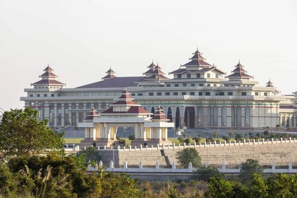
Myanmar built Naypyidaw in 2005 on mostly undeveloped territory north of Yangon and organized it through a rigorously controlled, highly segregated layout. Planners separated economic, residential, and hotel zones across vast distances, while ten-lane highways, large roundabouts, and long transportation corridors dominate the plan. The Pyidaungsu Hluttaw parliament complex serves as the institutional center, yet it is geographically isolated and disconnected from any meaningful civic or pedestrian life.

Naypyidaw’s architecture regularly incorporates existing Yangon symbols. The Uppatasanti Pagoda is almost identical to the Shwedagon Pagoda, being one foot shorter and having a hollow base. City Hall is also a duplicate of Yangon’s imitation of the originals. Its two sporting complexes for the 2014 Southeast Asian Games, Wunna Theikdi and Zeyar Thiri, are identical despite being 35 kilometers apart.
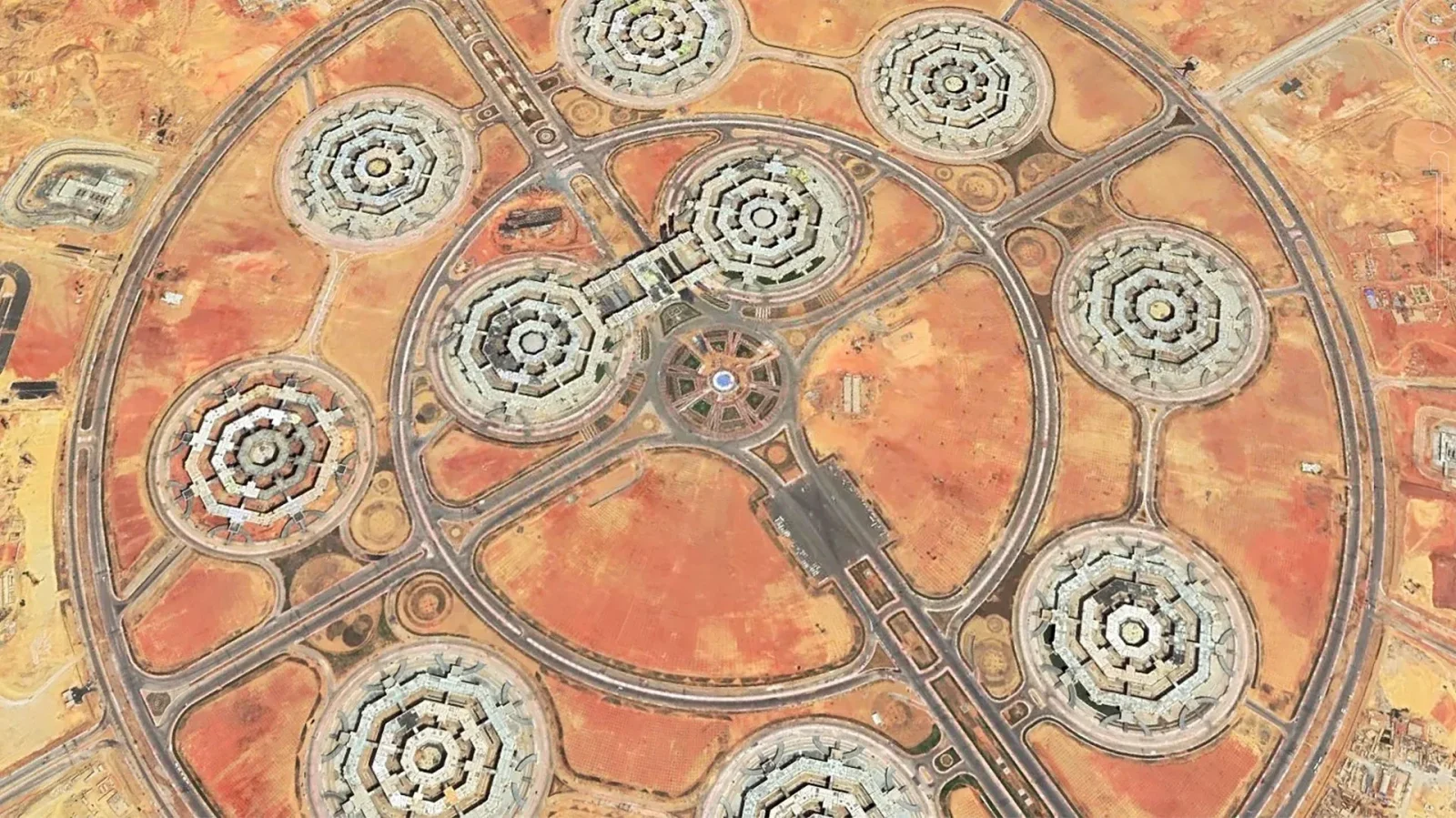
New Administrative Capital or The New Capital

Country: Egypt
Egypt’s New Administrative Capital lies on the desert border east of Cairo, with a master plan dividing the city into political, financial, cultural, and residential districts within a tight geometric grid. The Central Business District forms the heart of the city, with the Iconic Tower anchoring the district with a 385-meter concrete-and-glass obelisk. A massive parliamentary complex dominates the governmental core, placed beneath a 55-meter dome. Its design draws inspiration from abstracted pharaonic themes, lotus geometry, rhythmic colonnades, and symmetrical planning.

Nearby, the Ministry of Defence’s Octagon surpasses the Pentagon in scale, while the Mosque of Egypt and Cathedral of Nativity encompass ceremonial boulevards and large public spaces. Designers softened the desert composition with a city park containing an artificial river, promenades, and civic plazas. The city functions as a controlled smart capital with a command center monitoring infrastructure, traffic, utilities, and surveillance systems, while residential districts unfold through gated compounds connected by highways.
Ciudad de la Paz

Country: Equatorial Guinea
Ciudad de la Paz, built from the ground up in eastern Equatorial Guinea’s woods, is a planned administrative city. Conceived as part of a decentralization strategy, the city reorganizes political authority through an orderly urban framework with large ceremonial avenues, orthogonal grids, and hierarchical highways that divide the city into functional areas. At its heart is a grand civic core that houses the presidential palace, parliament, ministries, and huge public plazas while residential and commercial neighborhoods radiate outward into the surrounding forest landscape.

Planners incorporated green corridors and river systems as major organizing features rather than residual open space. Architecturally, the city combines enormous government buildings with conference centers, residential towers, and municipal infrastructure. Here, engineers installed fiber-optic networks, surveillance systems, and new utilities throughout previously undeveloped areas.
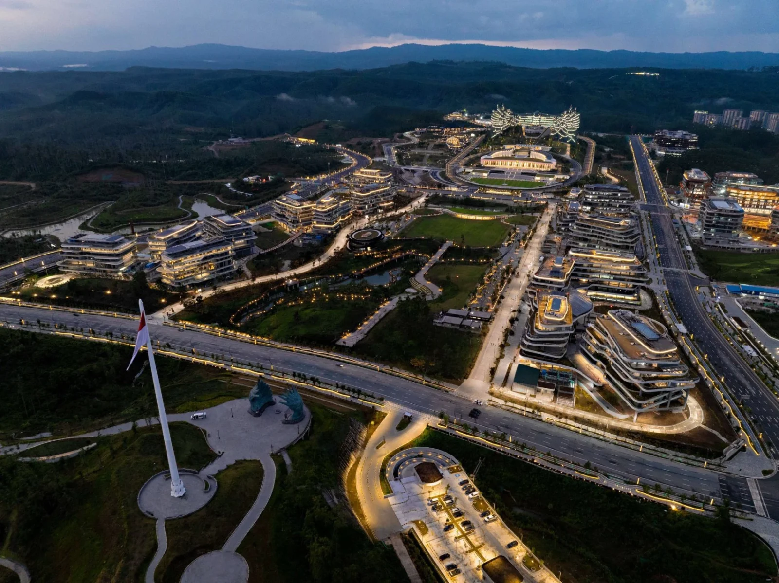
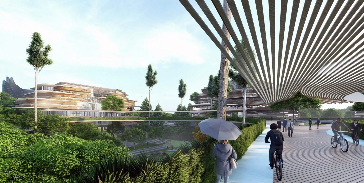
Nusantara

Country: Indonesia
Building in phases, Nusantara is Indonesia’s next capital in East Kalimantan, owing to Jakarta’s worsening environmental conditions and decades of groundwater extraction that have left much of the city highly flood-prone. Beginnings with the Government Central Area include ministries, public institutions, schools, hospitals, and civic infrastructure. This carbon-neutral forest city proposes to move Indonesia’s political and economic center away from heavily populated Java and toward a more central position within the archipelago.

Its master plan integrates solar energy, autonomous transport, digital networks, and green corridors into the rainforest landscape. The city’s axis has symbolic meaning rooted in pre-Islamic Javanese cosmology, with the vertical orientation towards elevated terrain representing heaven and ancestors, and the horizontal axis flowing into Balikpapan Bay.
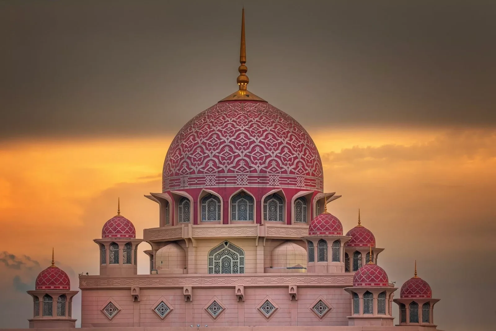
Putrajaya

Country: Malaysia
Malaysia established Putrajaya as its federal administrative capital in 1999, south of Kuala Lumpur, on former rubber and oil palm farms. Designed as a Garden City, Putrajaya centers on a boulevard spine with Putrajaya Lake and its waterfront organizing the city around water and landscape. Its architecture combines contemporary construction with Islamic design traditions through arabesque, geometric, and floral patterns.

The rose-granite Putra Mosque, one of the world’s only pink mosques, reinterprets classical Islamic forms, whereas the Iron Mosque takes an opposite approach with its cutting-edge steel-and-glass structure. Overlooking the lake, Perdana Putra anchors the administrative core with its distinctive mint-green dome.

Landscape infrastructure remains central to the city’s identity, with parks, wetlands, bicycle routes, and landscaped public spaces, while civic buildings incorporate rainwater collection and solar energy systems. At the same time, Putrajaya operates as a tightly managed smart city, where digital surveillance and centralized systems regulate traffic, infrastructure, and environmental performance.
These planned capitals reveal how architecture and urban design can transform empty landscapes into political, cultural, and economic centers, shaping national identity while reflecting each country’s ambitions for the future.
Explore Courses
.jpg "Ondrej Chybik - Rethinking Architecture")


