


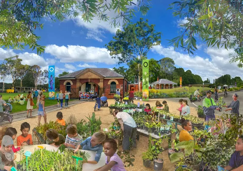
Sydney Olympic Park 2050 in Australia imagines a nature-positive future that blends high-density urban living with 430 hectares of protected parklands. The plan honors the Wangal people by integrating their cultural heritage throughout the suburb. Building on its legacy as the site of the first Green Games, the 2050 vision advances sustainability through cutting-edge circular economy strategies and ambitious decarbonization goals.
Future Urbanism and Social Infrastructure

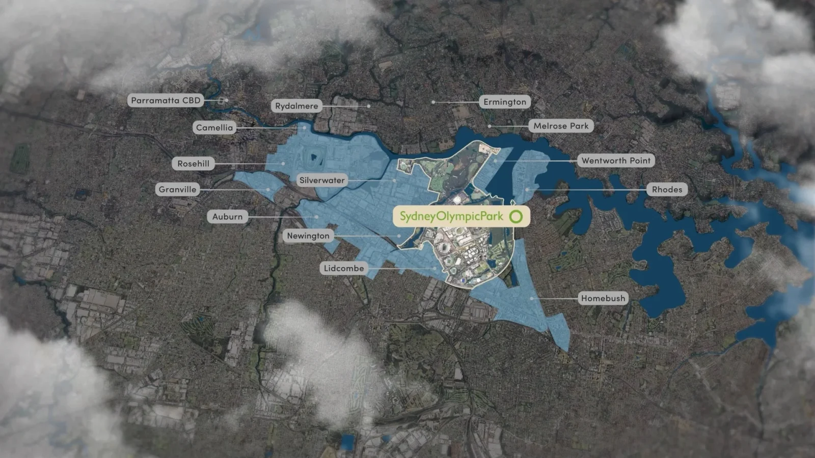
Guided by the Sydney Olympic Park Authority (SOPA) and the New South Wales Department of Planning, Housing and Infrastructure, the plan seeks to resolve the historical disconnect between the precinct’s large-scale infrastructure and the everyday needs of a residential community.

The Master Plan 2050 is not a standalone document but the culmination of a staged planning process. Stage 1 involved developing the Strategic Place Framework, which established high-level aspirations aligned with the Sydney Olympic Park 2050 Vision and Strategy. The final plan incorporated 2,000 homes into the draft, addressing Sydney’s broader housing crisis.
The Strategic Place Framework

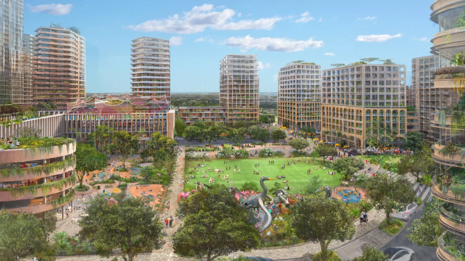
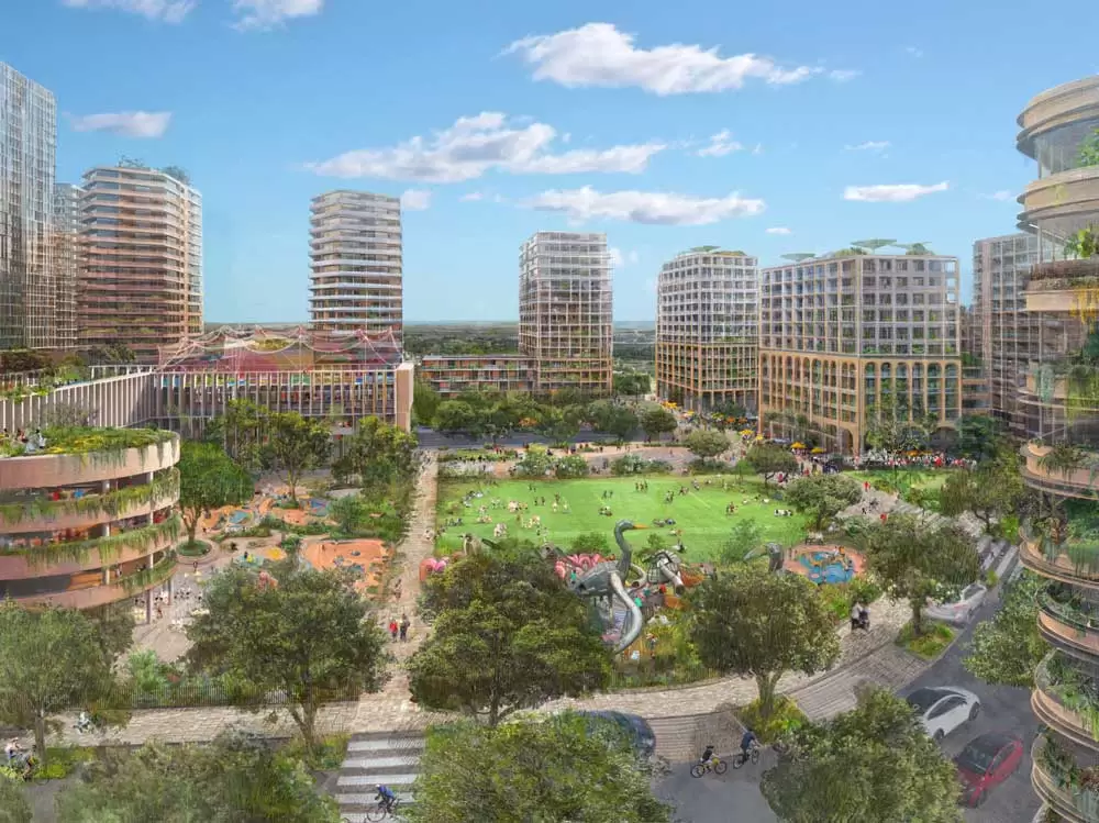
The current residential population of Sydney Olympic Park stands at approximately 5,000 but is forecast to reach between 30,000 and 33,000 by 2050. This represents growth of over 450%, necessitating a significant expansion of social infrastructure. To meet this demand, the Master Plan 2050 allocates land for ten new playgrounds, nine outdoor public spaces, and four new sports fields.

The design integrates two new school sites, a new library and community hub, and a cultural center. The plan envisions a vertical suburb, with residential units located on lower floors of towers or centralized in community clusters. At the core of the 2050 housing strategy is a commitment to key workers and social housing.
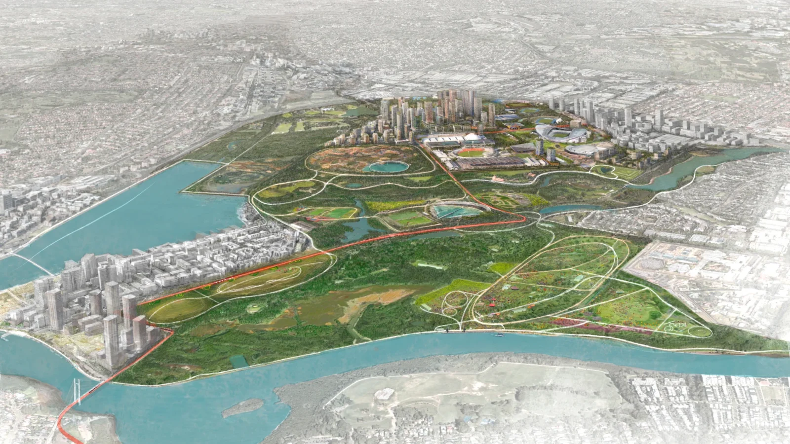
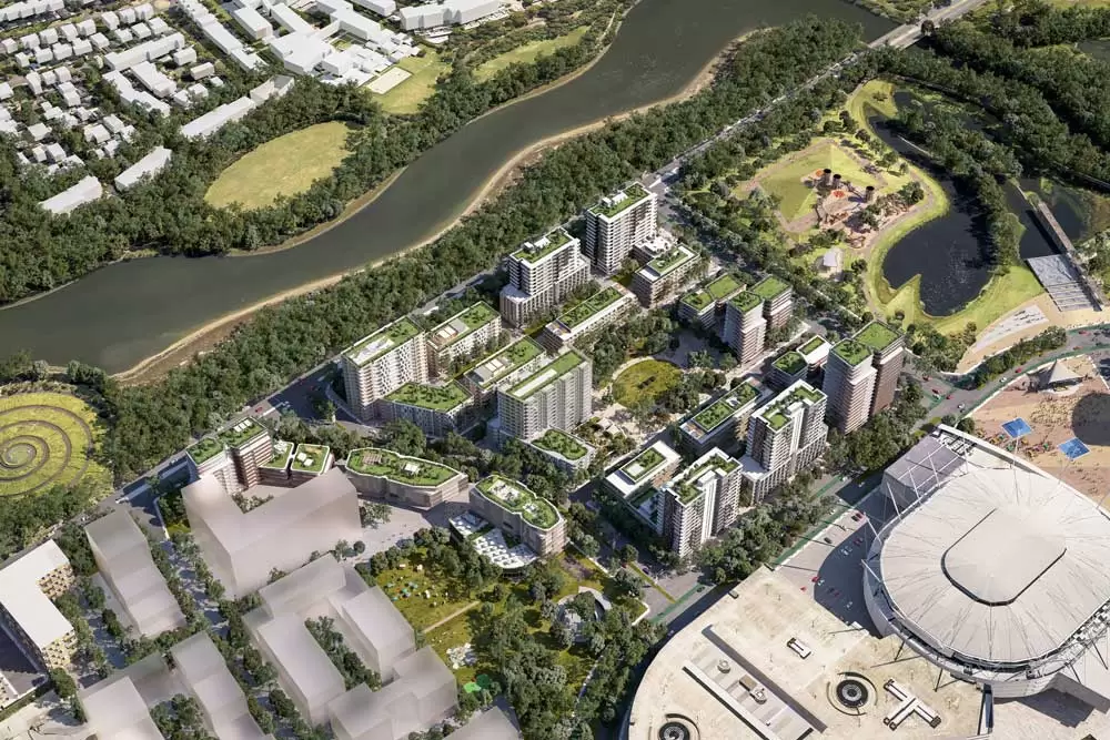
Urban Design: The Five Neighbourhoods
Given the 640-hectare site’s scale, the Master Plan organizes it into five distinct neighborhoods rather than treating it as a single uniform area:
1. The Urban Centre

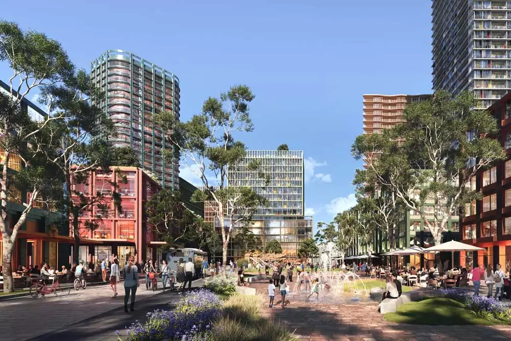
The Urban Centre is designed as a vibrant mixed-use hub where residential, commercial, and retail activities overlap. These new public spaces will serve as primary gathering points. The State Abattoir heritage precinct will be transformed into a cultural and community anchor, housing the new library and multi-functional spaces. Significantly, high-rise residential and commercial towers will be built directly above the metro and train stations to maximize transit-oriented efficiency.
2. Eastern Neighbourhood

Located between the Urban Centre and Bicentennial Park, this neighborhood is defined by its striking verticality and visual connection to the parklands. It is the primary candidate for a new primary school and indoor recreation facilities. The existing P6 car park will be converted into residential buildings overlooking the Brickpit.
3. Southern Neighbourhood

A major pedestrian and cyclist bridge over Sarah Durack Avenue is proposed to link southern residents to the Urban Centre and the metro safely. To support the car-lite vision, a micro-freight transfer hub will be established here to manage local deliveries, reducing the presence of heavy vehicles in residential streets.
4. Haslam’s Neighborhood

Situated on the western edge of the precinct along Haslams Creek, this neighborhood will transform industrial and parking land into a residential enclave. Buildings will range from six to twenty storeys.
5. Edwin Flack Neighbourhood

This area provides the northern transition to the Carter Street Precinct and focuses on diverse dwelling types. The plan encourages student housing, visitor accommodation, and innovative build-to-rent models in this sector.
Photo Credit: © NSW Government
Explore Courses


.jpg "Ondrej Chybik - Rethinking Architecture")


