


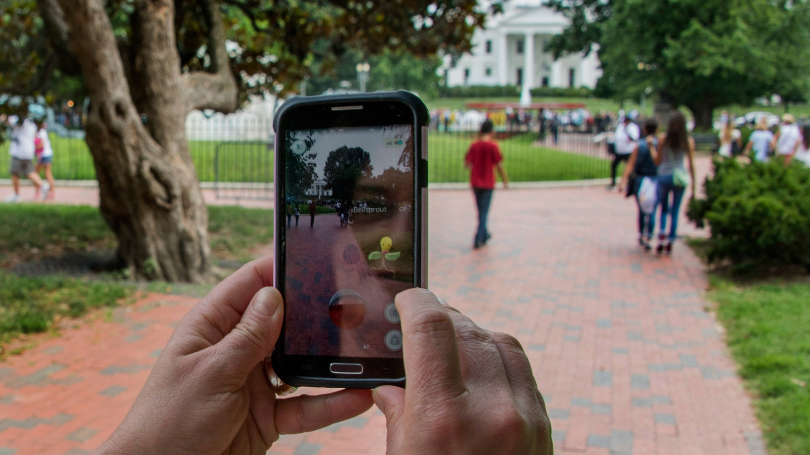

When the augmented-reality game Pokémon Go launched in 2016, it quickly became one of the most widely played mobile games in the world. Millions of players explored real-world locations with their smartphone cameras to capture virtual creatures placed in physical environments. What appeared to be a gaming phenomenon has now evolved into an effective technological resource.
Nearly a decade later, data generated by Pokémon Go players is being used to train computer vision systems that help autonomous delivery robots navigate complex urban environments. According to reports from MIT Technology Review, images collected through the game have contributed to a dataset of more than 30 billion real-world images, which are now powering navigation systems used in robotics.
This development explains how large-scale crowdsourced data generated through consumer applications can later become foundational for advanced artificial intelligence and robotics technologies.
The Data Collection Mechanism Behind Pokémon Go
Pokémon Go was designed as an augmented-reality game that required players to physically move through real environments while viewing their surroundings through a smartphone camera. Digital Pokémon were overlaid on real-world locations such as parks, monuments, and public landmarks.

During gameplay, players often scanned or photographed real-world locations known as PokéStops and Gyms to complete in-game tasks or research activities. These scans captured images along with metadata from the device sensors, including GPS coordinates, camera orientation, motion data, and environmental context.
These interactions seemed like normal gameplay mechanics when looked at one at a time. However, when aggregated across millions of users worldwide, they created a massive repository of visual and spatial data representing urban environments. The data captured images from multiple angles, under different lighting conditions, weather scenarios, and times of day, providing highly diverse training material for computer vision systems.

According to Niantic, the company behind Pokémon Go, the resulting dataset contains roughly 30 billion images tied to precise spatial information, effectively forming a large-scale visual map of real-world locations.
Building a Visual Positioning System (VPS)
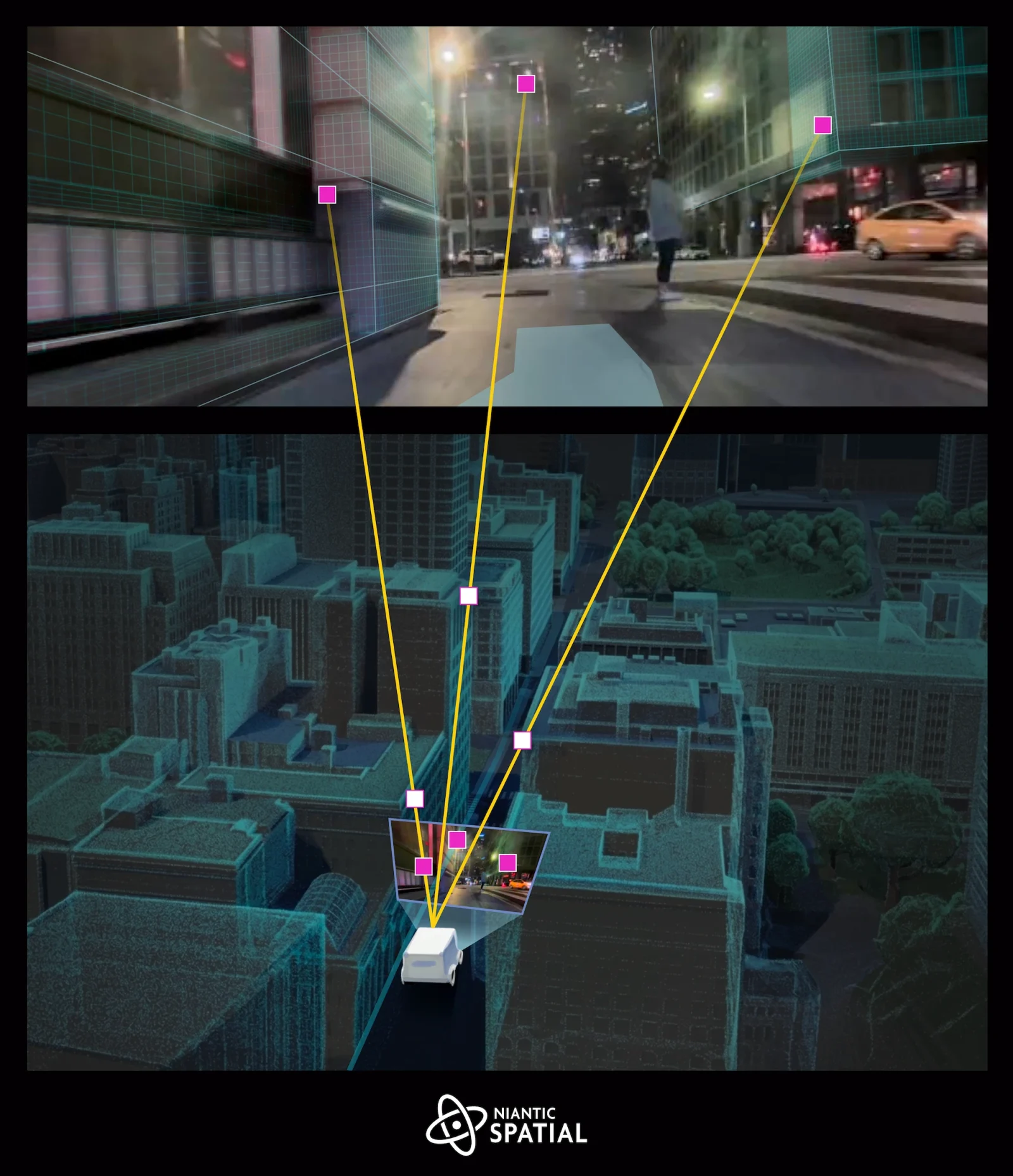
A technology called a Visual Positioning System (VPS) has been trained using the data from Pokémon Go. VPS is a computer vision-based navigation method that determines a device’s precise location by analyzing visual features in the environment, such as buildings, signs, and landmarks.
VPS identifies the position by comparing live camera images with previously recorded images in a reference database. If the system recognizes the environment, it can calculate the device’s position with very high accuracy.

Niantic’s VPS system reportedly uses the Pokémon Go dataset to localize devices within a few centimeters by matching camera images to the stored visual map.
This capability is particularly useful in dense urban areas where GPS signals are often unreliable due to signal interference from tall buildings, a phenomenon commonly referred to as the “urban canyon” effect.
Application in Autonomous Delivery Robots
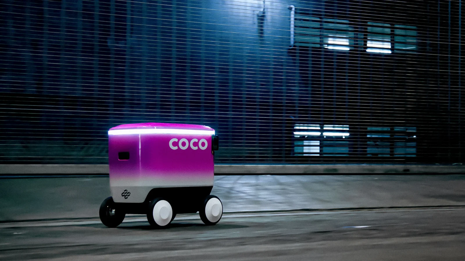
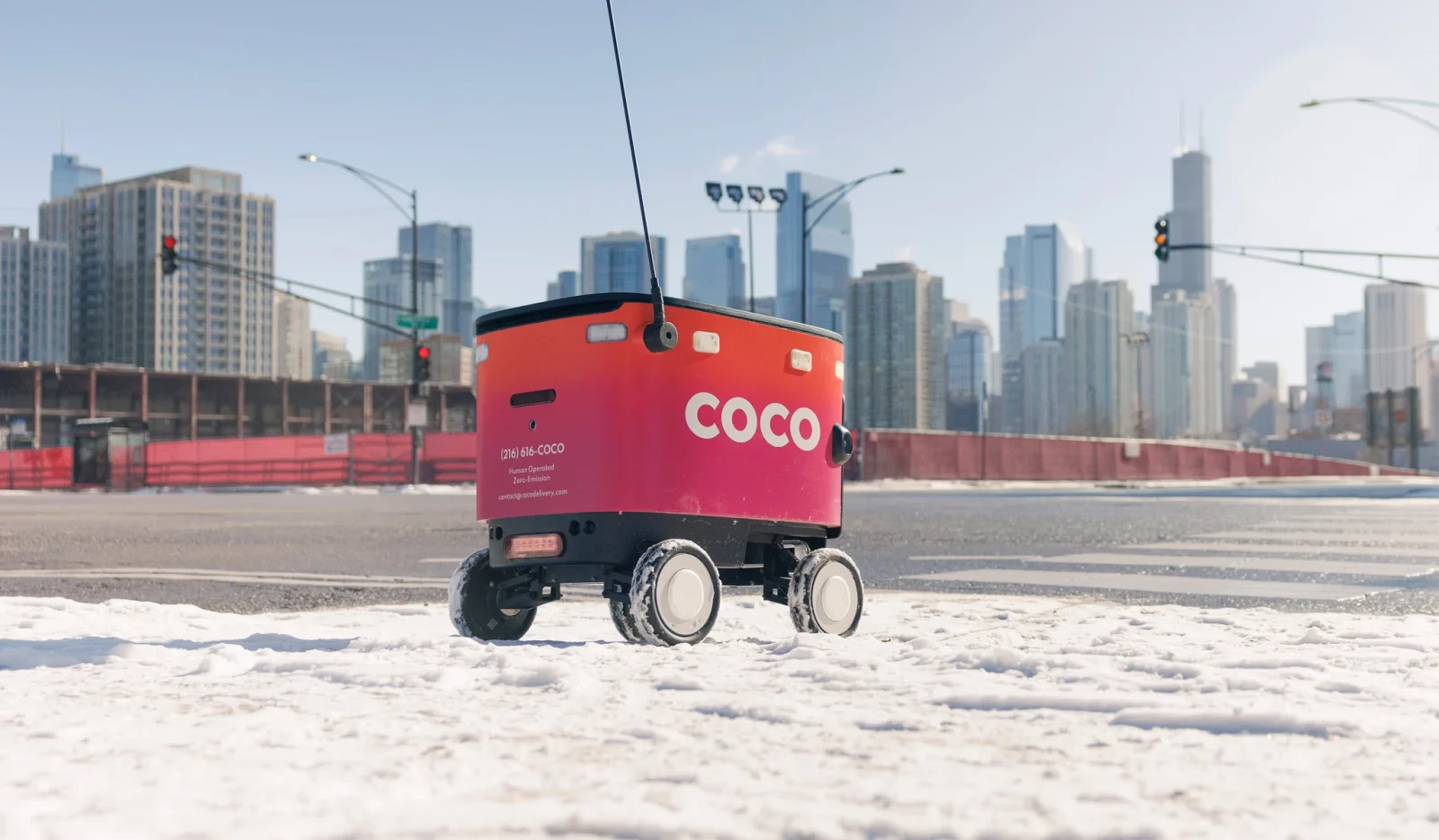
The dataset is now being used in a partnership between Niantic Spatial, a spatial computing division of Niantic, and Coco Robotics, a company that develops small autonomous robots designed for short-distance deliveries.

These robots operate on sidewalks to deliver food and groceries. They are equipped with cameras that continuously scan their surroundings. By comparing these images with the VPS database trained on Pokémon Go scans, the robots can determine their exact location and orientation relative to buildings and other landmarks.
This visual localization helps robots navigate city streets more reliably, particularly in areas where GPS alone might produce inaccurate location readings.

Niantic Spatial CEO John Hanke explained that the technical challenge of placing virtual Pokémon accurately in real environments is closely related to the challenge robots face when navigating those environments. In an interview referenced by reports, he stated that positioning a Pokémon in the world and guiding a robot through that same space involves similar spatial computing techniques.
The Scale of the Crowdsourced Dataset
The scale of the dataset is one of its most significant technological features. Pokémon Go attracted hundreds of millions of players globally after its launch, reaching approximately 230 million monthly active users at its peak.
Because players captured images from different devices and perspectives, the dataset includes multiple views of the same location. This multi-view data enables machine learning models to construct 3D representations of physical environments, allowing AI systems to understand spatial relationships between objects and structures.
Many of the images are concentrated around more than one million frequently visited locations, creating dense visual coverage of urban landmarks and public spaces.
Such datasets are valuable for training robotic perception systems, which must recognize and interpret real-world environments to operate safely.
Implications for Robotics and Spatial AI
The use of Pokémon Go data represents a broader trend in robotics and artificial intelligence: the development of world models that allow machines to understand the physical world. Large-scale visual datasets provide the training material required for these systems to learn how to recognize objects, navigate spaces, and interpret complex environments.
For delivery robots, improved spatial awareness can lead to more reliable navigation, fewer delivery delays, and safer interactions with pedestrians. The technology may also support other applications, including augmented-reality devices, mapping systems, and autonomous vehicles.
However, the development has also sparked discussions about data usage and privacy, as many players were unaware that their gameplay interactions would eventually contribute to a large-scale dataset used for robotics research and commercial applications.

What began as a global augmented-reality gaming trend has evolved into a large-scale crowdsourced mapping system for artificial intelligence. By scanning landmarks and exploring real-world locations through Pokémon Go, millions of players unknowingly contributed to a dataset of over 30 billion images that now supports advanced navigation systems for delivery robots.
This case demonstrates how consumer technology platforms can generate massive datasets that later become valuable for fields such as robotics, spatial computing, and machine learning. As companies continue to develop technologies that rely on real-world perception, crowdsourced data may increasingly play a central role in training the AI systems that operate in physical environments.
Explore Courses


.jpg "Ondrej Chybik - Rethinking Architecture")


