




Ancient builders chose city sites based on a short list of practical tests: reliable water, flood protection, access to farmland, defensible ground, and proximity to trade routes. Rivers drove most decisions. Cities in the Indus Valley, Mesopotamia, and Egypt grew on floodplains, then added platforms, drains, and canals to manage the rivers that fed them. Where water was scarce, as in Gujarat, the layout began with water storage.
Religion and astronomy added further rules. Builders aligned streets with cardinal directions, solstices, or sacred mountains and placed temples at the center or at the end of a main axis. Few of these ancient cities followed written codes, yet many show tight control over street widths, brick sizes, and district boundaries.
Cities appeared once farming produced surplus food. By about 3500 BCE in southern Mesopotamia, farmers could feed people who did not grow crops, such as priests, scribes, potters, and soldiers. Grain had to be stored, counted, and distributed, which required shared granaries, record-keeping, and someone in charge.
Trade added another need: goods from distant regions had to be exchanged in a place with markets, warehouses, and standard weights. Defense mattered too, since stored grain attracted raiders, and walls let a community protect its food and tools. Temples and palaces gave settlements a ritual and political center that held large populations together.
Planning began when these demands outgrew informal growth. Moving water, draining waste, storing grain, and directing crowds to festivals all work better with a set pattern. Rulers also used layout to display authority, placing monuments on axes that everyone could see. Planning was therefore a response to logistics, security, and ritual at the same time. This list covers 15 ancient cities, each chosen for one planning idea that sets it apart from the rest.
1. Mohenjo-daro, Pakistan
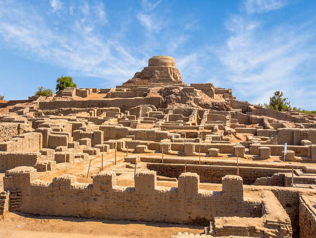
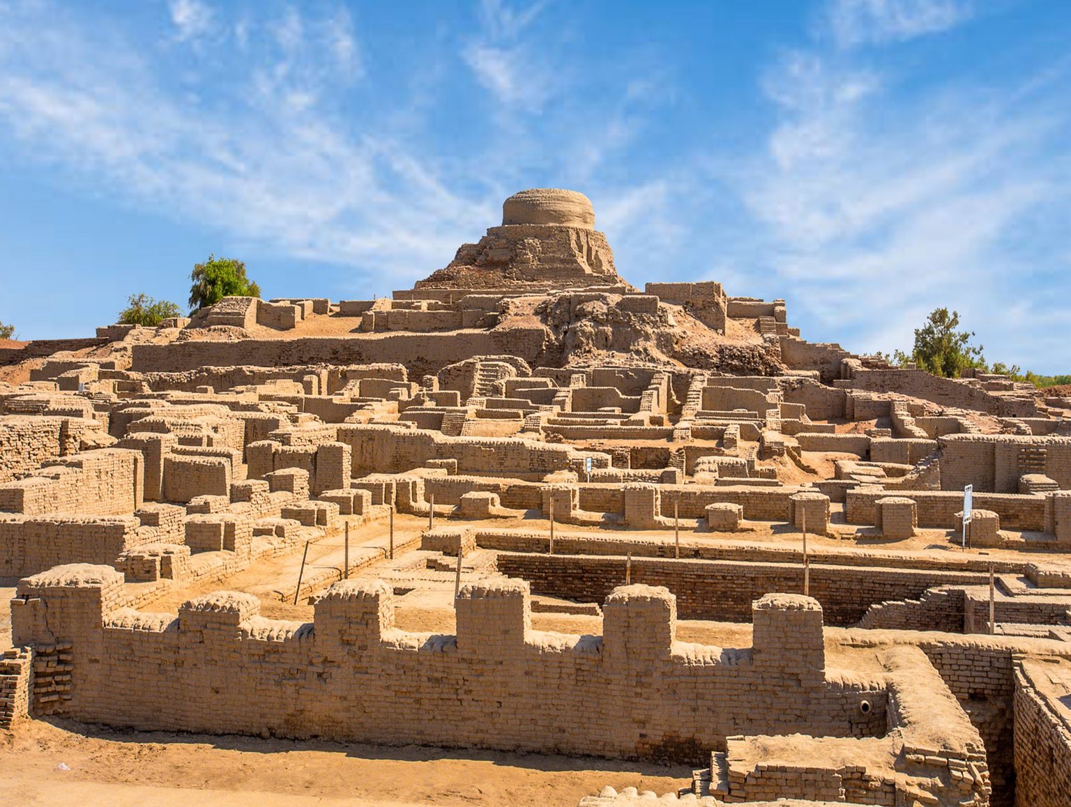
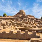
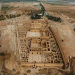
Mohenjo-daro (c. 2500 BCE) is known for its sanitation network. Main streets follow a grid aligned to the cardinal directions, and the widest is about 9 meters (30 feet). A raised citadel sits to the west of the lower town. No clear palace or temple has been identified in either area, which is unusual for a city of its size. Houses faced inward onto courtyards and opened to narrow side lanes. Most had a bathing platform that drained through a terracotta pipe into a brick-lined sewer under the street.
The sewers were covered with bricks or stone slabs, and sections could be lifted for cleaning. Excavators have recorded roughly 700 wells, so households rarely walked far for water. Fired bricks followed a 4:2:1 ratio of length to width to thickness, which kept construction consistent across the city. The Great Bath on the citadel, about 12 by 7 meters, was waterproofed with bitumen. Population estimates range from about 20,000 to 40,000. Drainage and standardization were part of the street design from the start.
2. Dholavira, India
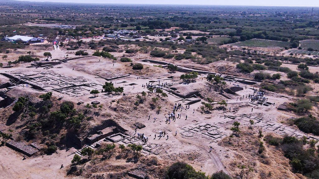
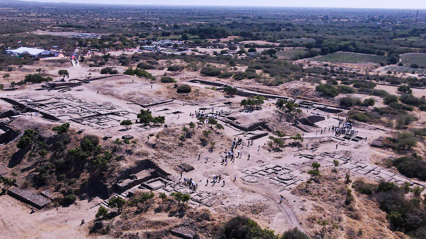
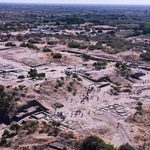
Dholavira sits on Khadir island in the arid Rann of Kutch, so water storage shaped the entire plan. The Harappan city has three nested divisions: a citadel, a middle town, and a lower town. Stone-lined channels diverted runoff from two seasonal streams into about 16 reservoirs of different sizes, built within and around the walls. Some were cut directly into rock. Because clay was scarce, builders used local sandstone and limestone for walls and structures. A large open ground beside the citadel, about 283 meters long, probably hosted public gatherings.
At the Citadel’s North Gate, archaeologists discovered an inscription of ten large Harappan-script symbols—likely originally hung above the entrance—making it one of the earliest known examples of public signage. The city was occupied from roughly 3000 to 1500 BCE, and its decline is linked to increasing aridity in the region. UNESCO listed the site in 2021.
3. Ur, Iraq
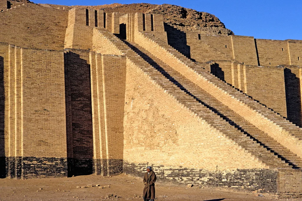
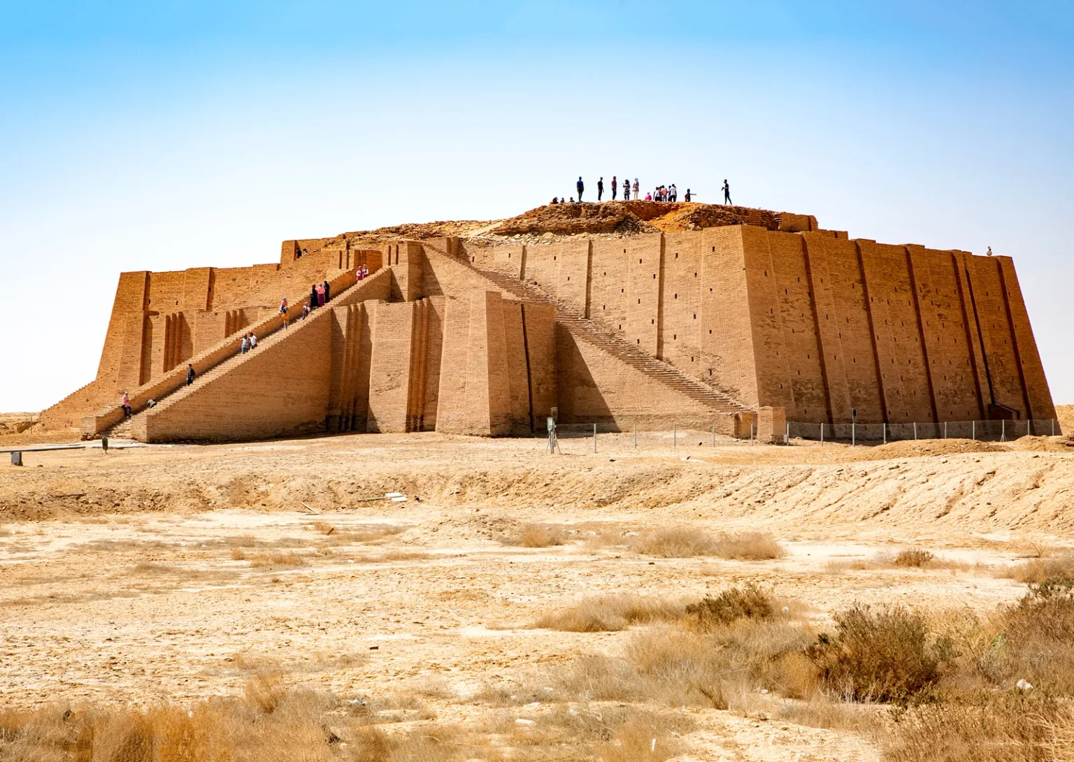
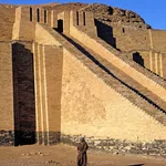
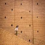
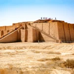
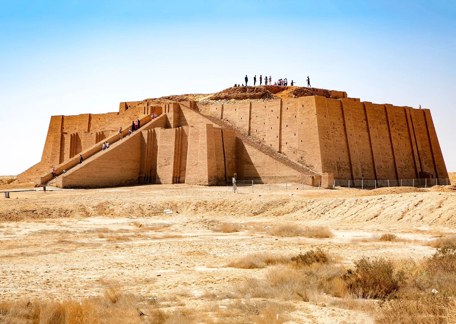
Ur shows how a Sumerian city organized itself around a religious and economic core. The ziggurat of Nanna, built around 2100 BCE under Ur-Nammu, stood inside a walled temple precinct that also handled storage and administration. The city itself was roughly oval, enclosed by a defensive wall, and the temple area occupied its northwest part. Around it, excavator Leonard Woolley documented dense neighborhoods of courtyard houses during digs in the 1920s and 1930s. The lanes were narrow and winding. Woolley reconstructed many houses with two stories, though that reconstruction is debated.
Thick exterior walls had few openings, and rooms faced an inner court for shade and privacy, a sensible response to a hot climate. Harbors on the north and west sides connected the city to river and sea trade, which explains why warehouses and offices clustered near the sacred precinct. The contrast between a monumental, controlled core and an organic residential fabric is the defining trait of the plan. It also shows how temples worked as economic institutions as well as places of worship.
4. Teotihuacan, Mexico
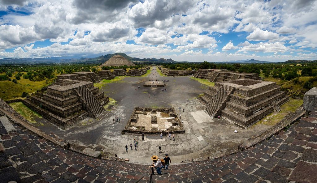
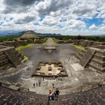
Teotihuacan applied one grid across a very large area. The grid is rotated about 15.5 degrees east of north, and the Avenue of the Dead forms its spine for roughly 5 kilometers (3 miles). The Pyramids of the Sun and Moon flank the avenue, and the Ciudadela with its temple of the Feathered Serpent sits near the center. Planners also redirected the San Juan River into a channel so it would fit the grid. At its peak, around 450 CE, the city likely held 100,000 or more people.
Most lived in walled apartment compounds with interior courtyards, each housing several families, and surveyors have identified about 2,000 of them. Some districts were occupied by migrants, including a neighborhood associated with people from Oaxaca, so the grid organized a diverse population. The Teotihuacan Mapping Project, led by René Millon in the 1960s, recorded roughly 20 square kilometers block by block, which is why this layout is so well documented.
5. Angkor, Cambodia
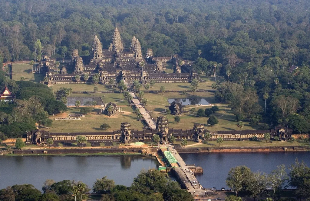
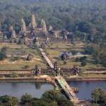
Angkor was organized by water infrastructure instead of a dense center. The Khmer built enormous rectangular reservoirs called barays, including the West Baray at roughly 8 by 2 kilometers, and linked them with canals and embankments. Temples, roads, and settlements were arranged along this network. Each temple was usually surrounded by a moat, which tied religious sites to the water system. At the walled city of Angkor Thom, built in the late 12th century under Jayavarman VII, a 3-kilometer square plan places the Bayon temple at the center.
LiDAR surveys since 2012 have revealed a low-density urban landscape spread over an estimated 1,000 square kilometers, with road grids and house mounds hidden under forest. Canals moved water for rice farming and controlled monsoon floods, and they also guided where people settled. Population estimates for the region vary widely, from several hundred thousand to about a million. Angkor is the strongest example on this list of a city planned as a hydraulic system first and a set of buildings second.
6. Hampi, India
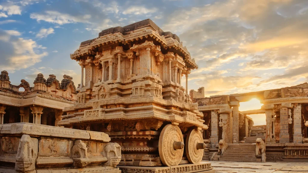
Hampi, the capital of the Vijayanagara Empire from 1336 to 1565, used its terrain as a defensive layer. Granite boulder hills were incorporated into fortification walls, and the Tungabhadra River covered the northern edge. Several fortification lines enclosed not only buildings but also farmland, reservoirs, and irrigation canals, so the city could feed itself during a siege. Weirs on the river diverted water into canals that served these fields. Planners also separated a sacred center along the river from a royal center to the south, each with its own character and street pattern.
A straight bazaar street, about 750 meters long, leads east from the Virupaksha Temple and was lined with covered colonnades for merchants. The city fell after the Battle of Talikota in 1565 and was sacked, and UNESCO listed the ruins in 1986. Hampi stands out for treating a whole landscape of rock, river, and farmland as one defensive and productive system, with the urban area as only one part of it.
7. Pompeii, Italy
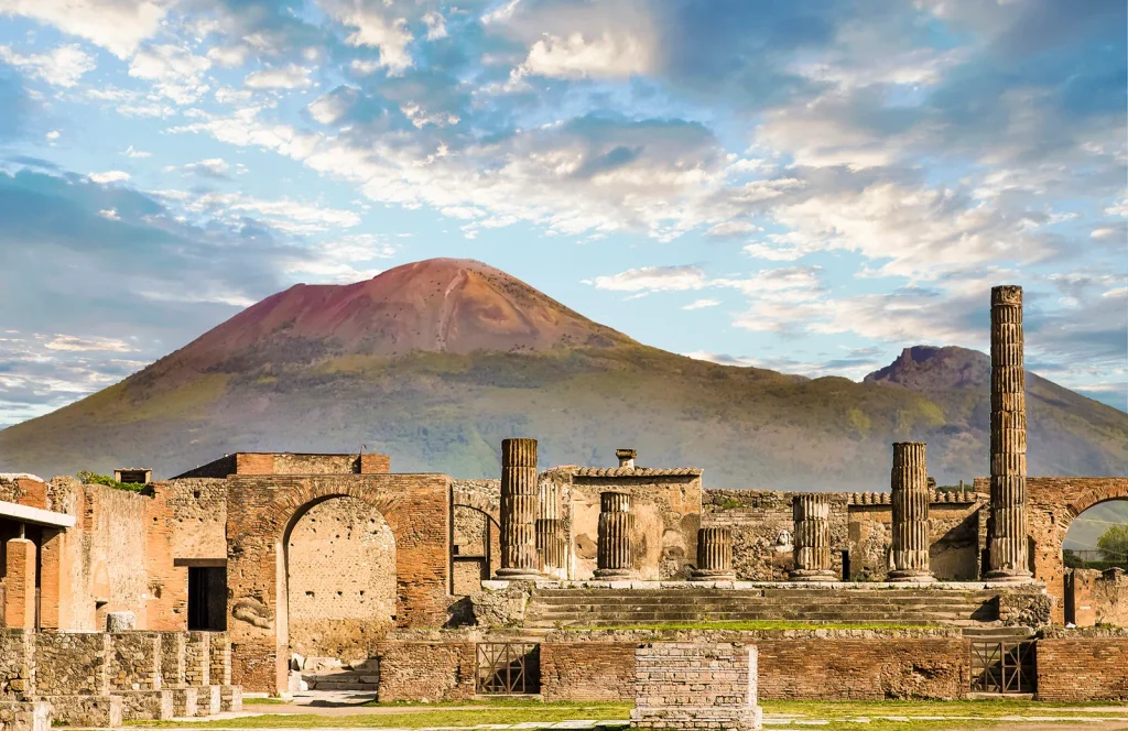
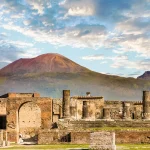
Pompeii is the best place to study how Romans engineered streets for mixed traffic. Basalt paving carried carts, and raised stepping stones at crossings let pedestrians stay above stormwater that ran down the streets. The gaps between stones match cart wheel spacing, and wheel ruts are still visible. Some streets were closed to vehicles with blocking stones, which is evidence of traffic control, and researchers have proposed one-way patterns on certain lanes.
Roughly 40 street-corner fountains supplied water, fed by an aqueduct and distributed through water towers. The city also records its own growth. The older southwest quarter has irregular lanes, while later sections follow a more regular grid. Via dell’Abbondanza, the main east-west street, was lined with shops and workshops, so commercial activity concentrated along the busiest route. The eruption of 79 CE preserved all of this, including shop counters, street signs, and painted notices.
8. Machu Picchu, Peru
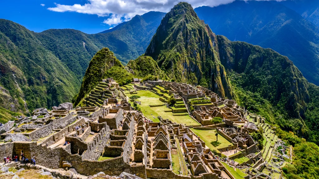
Machu Picchu was built around 1450 on a narrow ridge at about 2,430 meters (7,970 feet) in a rainy region. Drainage drove the design. Builders spent much of their effort underground, placing foundations of rock fill and gravel layers that let water pass through, and this is a major reason the structures have survived centuries of rain. Agricultural terraces on the slopes hold soil and prevent landslides. A wall and dry moat separate the farming sector from the urban sector, which is itself divided into upper and lower districts.
A stone channel carried water from a nearby spring through a series of about 16 fountains, so water ran from the top of the site to the bottom. The ridge also sits over fault lines, and the fractured granite supplied building stone close to the site, which reduced the need to haul material up the mountain. Machu Picchu works as slope engineering as much as architecture, and its terraces, walls, and paths function as one connected drainage and retaining system.
9. Tiwanaku, Bolivia
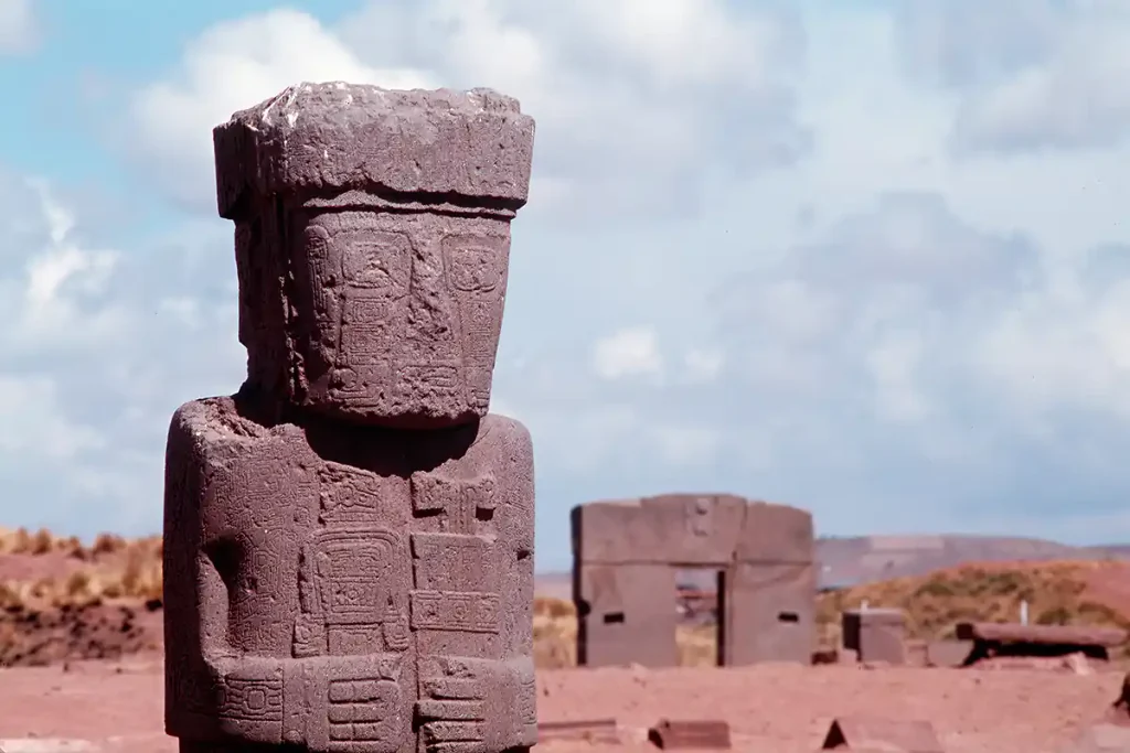
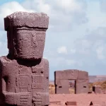
Tiwanaku sits at roughly 3,850 meters near Lake Titicaca and peaked between about 500 and 1000 CE. Its ceremonial core centers on the Akapana, a stepped platform about 16 meters tall with stone-lined drainage channels inside it. Researchers have proposed that the Akapana represented a sacred mountain with water flowing through it, and that a moat around the core formed a symbolic island, though the moat remains debated. Raised-field agriculture, called sukakollos, supported the population on the cold, flood-prone plain.
The raised beds drained excess water and held heat overnight, which protected crops from frost. Nearby buildings such as the Kalasasaya and Pumapunku use precisely cut andesite and sandstone blocks, some joined with metal clamps, which shows a high degree of masonry control. UNESCO listed the site in 2000. The key planning idea here is the link between cosmology and landscape: a ceremonial center built to model a mountain, supported by farming systems engineered for a harsh highland climate.
10. Persepolis, Iran
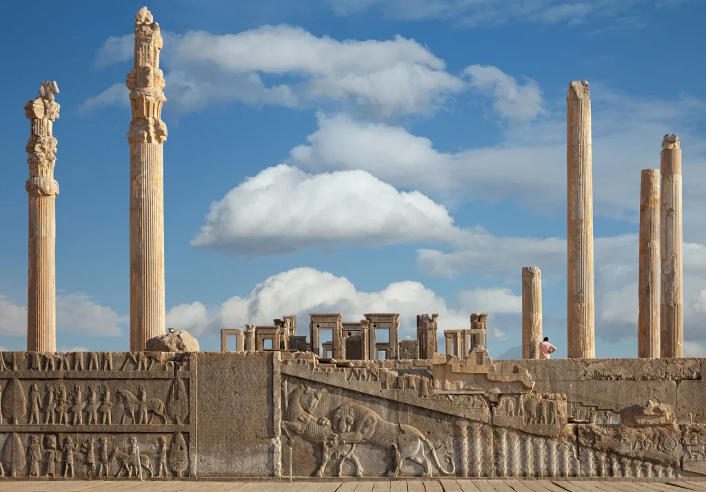
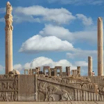
Persepolis was a ceremonial capital that Darius I began around 518 BCE, and its main idea is the artificial platform. Builders cut and filled a terrace of roughly 125,000 square meters against the Kuh-e Rahmat hillside and ran drainage tunnels through the rock beneath it. Visitors climbed a monumental double staircase, passed the Gate of All Nations built by Xerxes, and reached the Apadana, a hall with 72 columns. The Hundred-Column Hall and the Treasury stood nearby.
The sequence of gate, stairs, and hall was designed to control how arrivals were staged and who could enter each space. Relief carvings along the stairs show delegations from across the empire bringing gifts, so the circulation route also served as a political statement. The complex was not a conventional city with housing and markets. It was a royal precinct built for receptions and festivals, and Alexander the Great’s army burned it in 330 BCE.
11. Thebes, Egypt
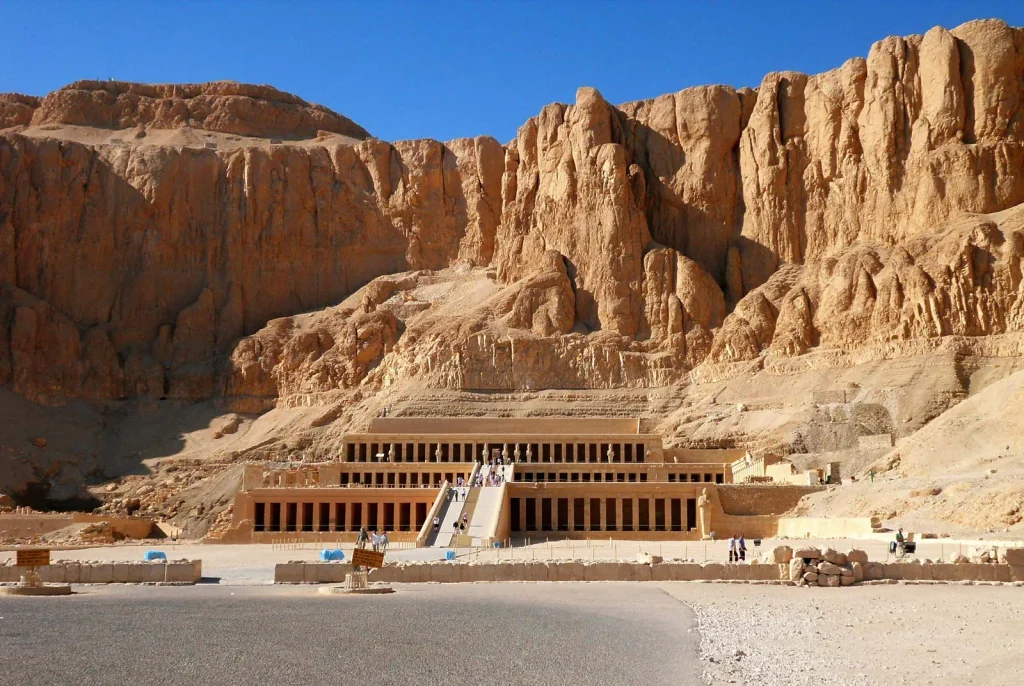
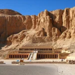
Thebes was divided by the Nile according to the sun’s path. The east bank, where the sun rises, held the living city, Karnak, and Luxor Temple. The west bank, where it sets, held the royal tombs, the Valley of the Kings, and funerary temples. About 2.7 kilometers of the Avenue of Sphinxes connected Karnak to Luxor Temple, forming a processional route for the Opet festival, and Egypt reopened the restored avenue in 2021. Hatshepsut’s temple at Deir el-Bahari lines up with Karnak’s main axis across the river.
On the west bank, Deir el-Medina was a planned village for tomb workers, founded in the early New Kingdom and laid out along a single main street with small, closely spaced houses of similar size. A wall enclosed the village. Its residents left written records on pottery fragments and papyrus, which give a detailed picture of daily life. Thebes is a city whose layout expressed a belief about life and death, with the river acting as the dividing line.
12. Arykanda, Türkiye
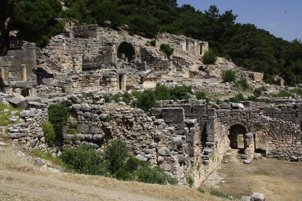
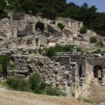
Arykanda is a mountain city in Lycia, organized on terraces. In the steep terrain, builders cut platforms into the slope and held them with retaining walls, then distributed public buildings across the levels. Stairs and a street running along the slope connected them. The main public buildings included an agora, a bath and gymnasium complex, a theater, and a stadium, each placed on its own platform. The theater faces out over the valley, so its location doubled as a viewpoint and gave audiences a landscape backdrop.
Vaulted substructures under some terraces created flat ground for larger buildings, a common Roman technique for working on slopes. The city was inhabited from the Hellenistic period through the Byzantine era, and its layout shows additions across those centuries. For architects, Arykanda shows how Hellenistic and Roman planning ideals were adjusted to a site where a flat grid was impossible.
13. Ephesus, Türkiye
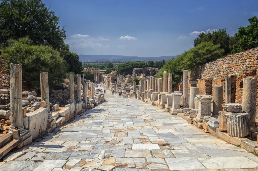
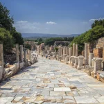
Ephesus moved because of a siltation problem. Silt from the Cayster River kept filling its harbor, and around 294 BCE Lysimachus relocated the city to a site between two hills. The earlier settlement had centered on the Temple of Artemis, so the move also shifted the city’s focus from a sanctuary to a new urban center. Later builders dredged and rebuilt the port, but silting continued, and today the ruins sit several kilometers from the sea. The Arcadiane, a colonnaded street of roughly 500 meters, linked the harbor to the theater and anchored the city’s main axis.
Curetes Street, lined with fountains, monuments, and public buildings, climbed toward the upper town and ended near the Library of Celsus. The Terrace Houses on the slope show how wealthy residents built multi-level homes with mosaics, heated floors, and courtyards. Ephesus shows a city repeatedly redesigned around one failing piece of infrastructure, and it is a useful case for how long-term environmental change can force an entire urban plan to shift.
14. Babylon, Iraq
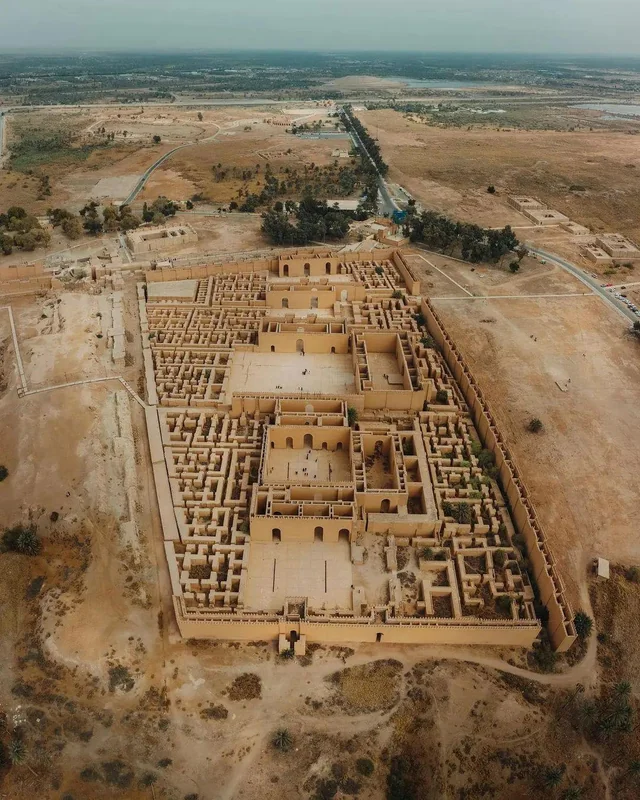
Babylon is defined by its Processional Way, a ceremonial route built under Nebuchadnezzar II in the sixth century BCE. It passed through the Ishtar Gate, faced with blue glazed brick and reliefs of dragons and bulls, and its walls were lined with lion figures. The route ran toward the Esagila temple and the Etemenanki ziggurat and was used during the Akitu New Year festival, when the statue of the god Marduk was carried through the city. The Euphrates divided Babylon into two halves joined by a bridge on brick piers, and double walls and a moat enclosed it.
Greek writers such as Herodotus described the city as vast and strictly laid out, though modern excavations show a smaller area than their accounts suggest. The Ishtar Gate was later reconstructed in the Pergamon Museum in Berlin. Here the street was a designed sequence of arrival, display, and ritual, and its glazed walls made the route recognizable from a distance.
15. Athens, Greece
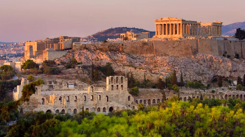
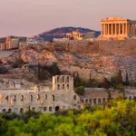
Athens built its civic life around the Agora. Located northwest of the Acropolis, it separated everyday governance and commerce from the religious hilltop. The Panathenaic Way crossed it diagonally, and boundary stones marked the limits of the civic zone. Public buildings, including the council house (Bouleuterion) and the Tholos, stood around an open square, while the Stoa of Attalus, built around 150 BCE, later added covered walkways for shops and meetings.
The American School of Classical Studies reconstructed the Stoa in the 1950s, and it now houses a museum. Housing outside this core was modest and the street pattern irregular. By contrast, the port of Piraeus was laid out on a grid, attributed to Hippodamus of Miletus. Athens put its building investment into shared public space, a choice that still shapes how planners discuss the civic realm.
Most of what we know about these layouts is recent and still incomplete. Teotihuacan’s block-by-block map came from fieldwork in the 1960s, and LiDAR has since revealed road and canal grids under the forest around Angkor. Dholavira gained UNESCO status only in 2021, and interpretations such as the Tiwanaku moat remain under debate. Preservation is also an active problem. At Mohenjo-daro, salts carried by groundwater damage the brick walls, and Pompeii’s excavated streets face weathering and heavy visitor traffic.