

For more than 4 centuries, the standard image of Earth hanging on schoolroom walls, printed in Atlases, and rendered across digital navigation screens has quietly misled humanity.
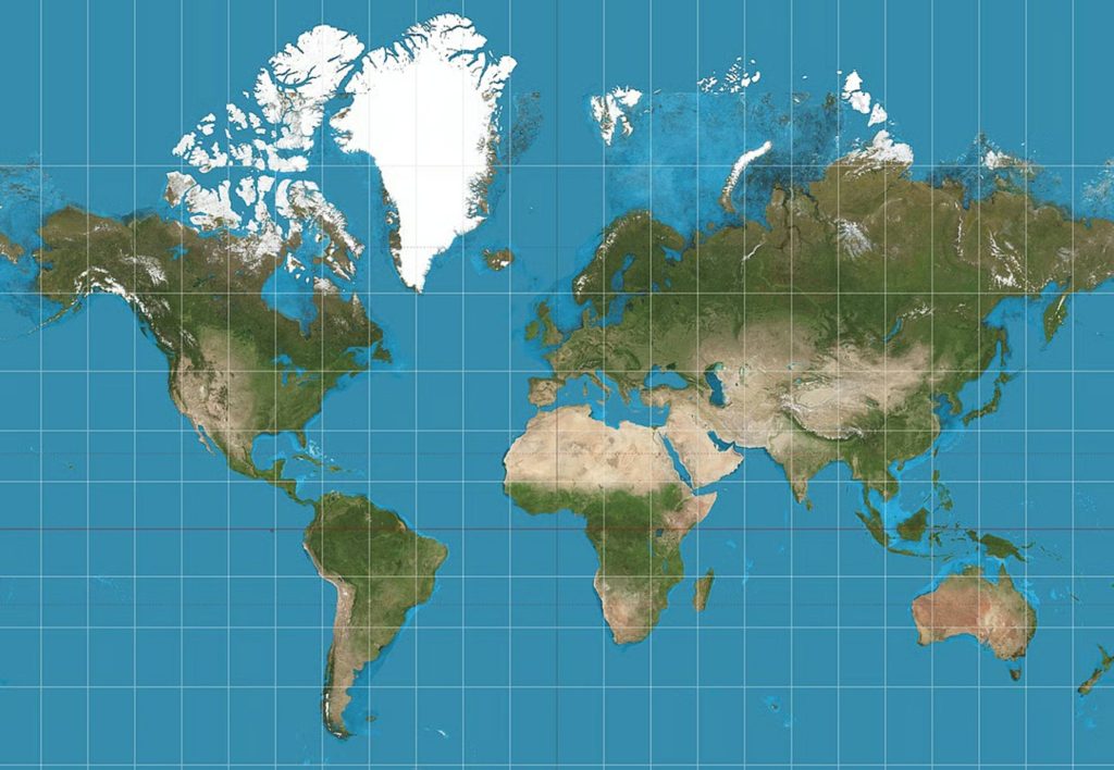
Created in 1569 by Flemish cartographer Gerardus Mercator, the dominant world projection was engineered for sea navigation, relying on straight rhumb lines to guide sailing ships across expansive oceans. To achieve constant compass bearings on a flat plane, the map stretched the latitude grid toward the poles. This mathematical compromise magnified Northern Hemisphere landmasses while shrinking equatorial continents.
That centuries-old visual consensus fractured on September 4, 2026.
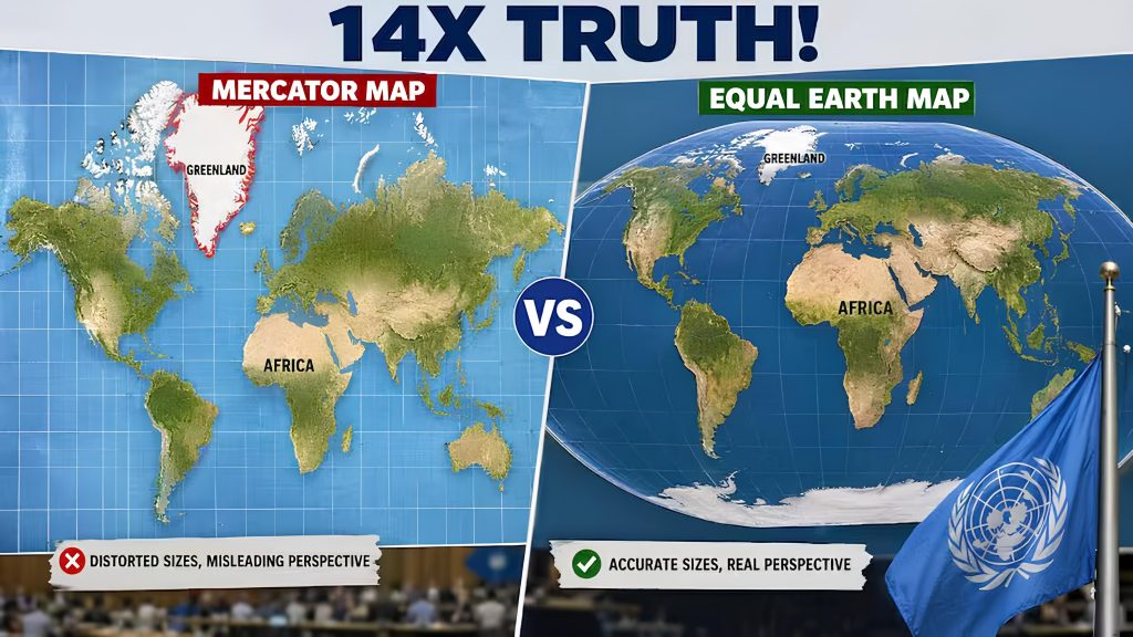
In a UN General Assembly session, 164 member states voted in favor of draft resolution A/80/L.104, titled “Correct the Map: Rebalancing global cartographic representation and promoting equitable representation of the world’s regions, particularly Africa.” Promoted by Togo on behalf of the African Group and backed by the African Union, the resolution urges institutions, educators, publishers, and media platforms to transition away from Mercator in favor of equal-area projections, specifically endorsing the modern Equal Earth projection.
The Geometry of Distortion: Why Mercator Distorts Spatial Scale
Projecting a three-dimensional sphere onto a flat surface inevitably introduces geometric compromises. Mercator’s cylindrical projection handles this by expanding latitude spacing as distance from the equator increases.This formula generates extreme scaling discrepancies:
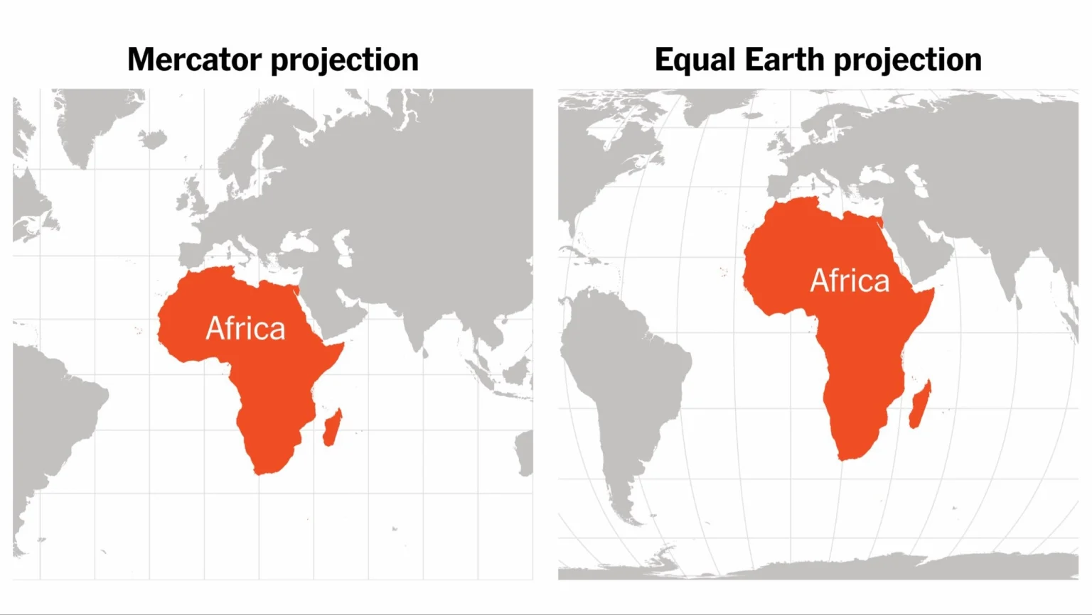
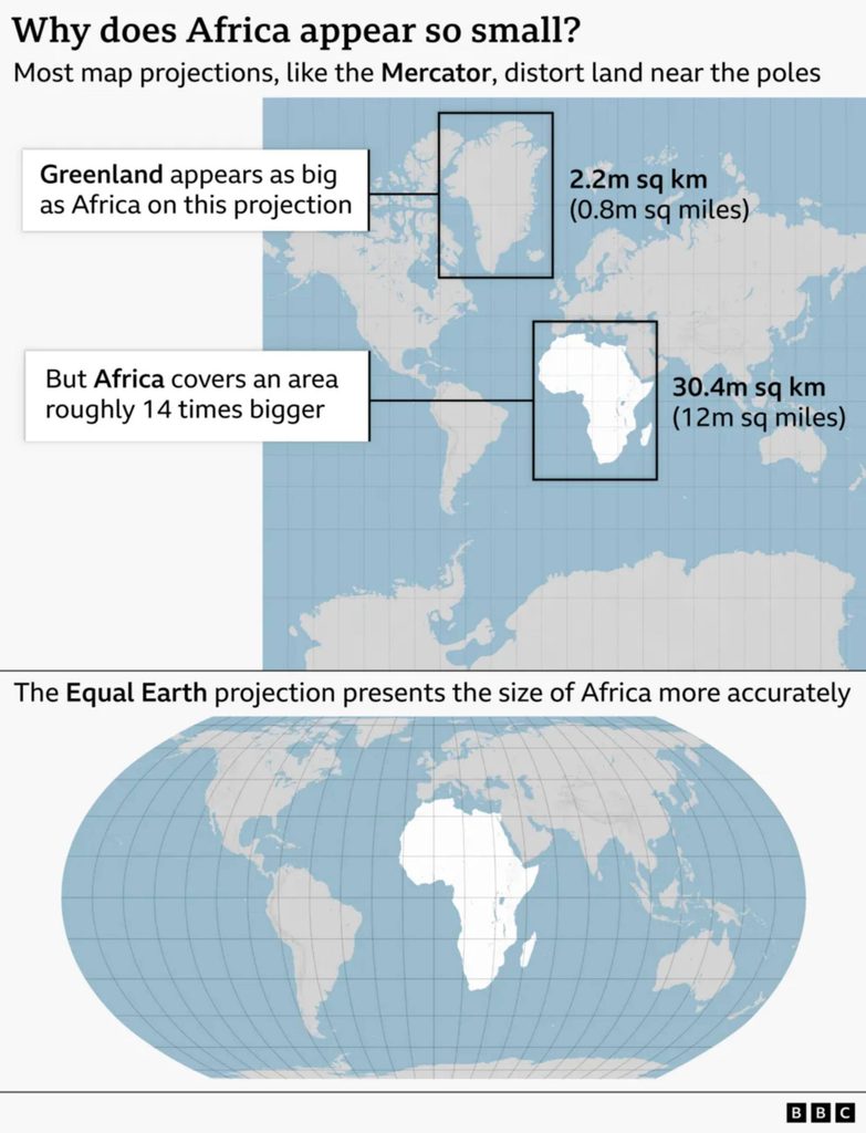
The Greenland Anomaly: On a standard Mercator map, Greenland and Africa occupy nearly identical visual footprints on paper. In reality, Africa covers 30.3 million square kilometers—making it roughly 14 times larger than Greenland ($2.16\text{ million km}^2$).
Hemispheric Visual Bias: Landmasses such as Europe, North America, and Russia appear artificially enlarged relative to tropical zones spanning South America, Central Africa, and South Asia.
The Equal Earth Solution & Mercator Cartography
Designed in 2018 by cartographers Bojan Šavrič, Tom Patterson, and Bernhard Jenny, the Equal Earth projection belongs to the pseudocylindrical equal-area class. The projection preserves curved outer meridians to mirror the visual familiarity of a globe while mathematically ensuring every landmass maintains an accurate relative area ratio ($1.0$) across all latitudes.
Under Equal Earth, the African continent assumes its physical spatial footprint, alongside accurate scaling for South America, India, and Southeast Asia.
Diplomatic Friction in the UN General Assembly
While the resolution passed with an overwhelmingly dominant majority of 164 votes, the debate on the General Assembly floor revealed sharp geopolitical fault lines over the role of cartography in international affairs.
The United States cast the sole vote against the initiative. Six nations abstained from the vote: Estonia, Georgia, Lithuania, Moldova, Serbia, and Ukraine.
Conversely, African representatives framed the vote as a crucial step toward “cognitive justice.” Representatives from Togo emphasized that correcting the map means recognizing that every region of the world deserves to be represented accurately and with dignity, asserting that cartographic representations directly influence how regions understand their global weight, development narratives, and historical standing.
Operational Implementation and Digital Mapping Pipelines
The UN resolution does not outlaw the Mercator projection or legally force private entities to alter their software. It acts as an international framework targeting educational materials, public communication platforms, and institutional basemaps.
Educational Systems: Member states are encouraged to update national school geography textbooks to incorporate equal-area maps in classrooms.
Digital Map Platforms: Cartographic agencies and advocacy groups are engaging with major digital mapping providers, web publishers, and GIS developers to transition default web basemaps away from Mercator for non-navigational applications.
Preserving Navigational Context: The initiative explicitly clarifies that Mercator remains useful for marine and aerial navigation, restricting the Equal Earth shift to thematic, educational, and general reference contexts.
Re-Engineering How Humanity Sees the Earth
Maps are more than neutral arrangements of grid lines and coastal borders; they serve as fundamental mental frameworks through which societies interpret geography, resource allocation, and international scale. By endorsing the Equal Earth projection, the United Nations General Assembly has initiated a structural shift in global geographic literacy. As textbooks are re-printed, digital basemaps updated, and newsrooms adapt, humanity is shedding a 450-year-old navigational compromise in favor of a map that reflects the true, proportional dimensions of our planet.